Blog

How to Plan a Backcountry Ski Tour in the Wasatch

An AMGA Ski Guide in the Wasatch Mountains of Utah, lays out the planning system behind a safe backcountry ski day in Utah's most accessible, and most compressed, mountain range. The piece starts with the map stack: the Wasatch Backcountry Skiing Map and its free companion guide, slope-angle shading in CalTopo, Gaia, or onX, and the Utah Avalanche Center observations feed, with an honest account of what each one can and can't tell you. From there it walks through a five-step tour plan, from reading the danger rose to drawing no-go polygons on the map to setting turnaround times and decision points before anyone leaves the kitchen table. A long section on terrain management covers the 30-degree threshold, why north and northeast above 9,500 feet accounts for most Utah fatalities, and the hard lesson of the 2021 Wilson Glade accident on a 31-degree glade. It then goes canyon by canyon: Millcreek, Big and Little Cottonwood, the Park City ridgeline, the Southern and Northern Wasatch, and covers the parking, road closure, traction law, transit, and watershed rules that sink more tours than weather does.

How to Plan a Backcountry Ski Tour in the Wasatch -

By Erik Fullmer

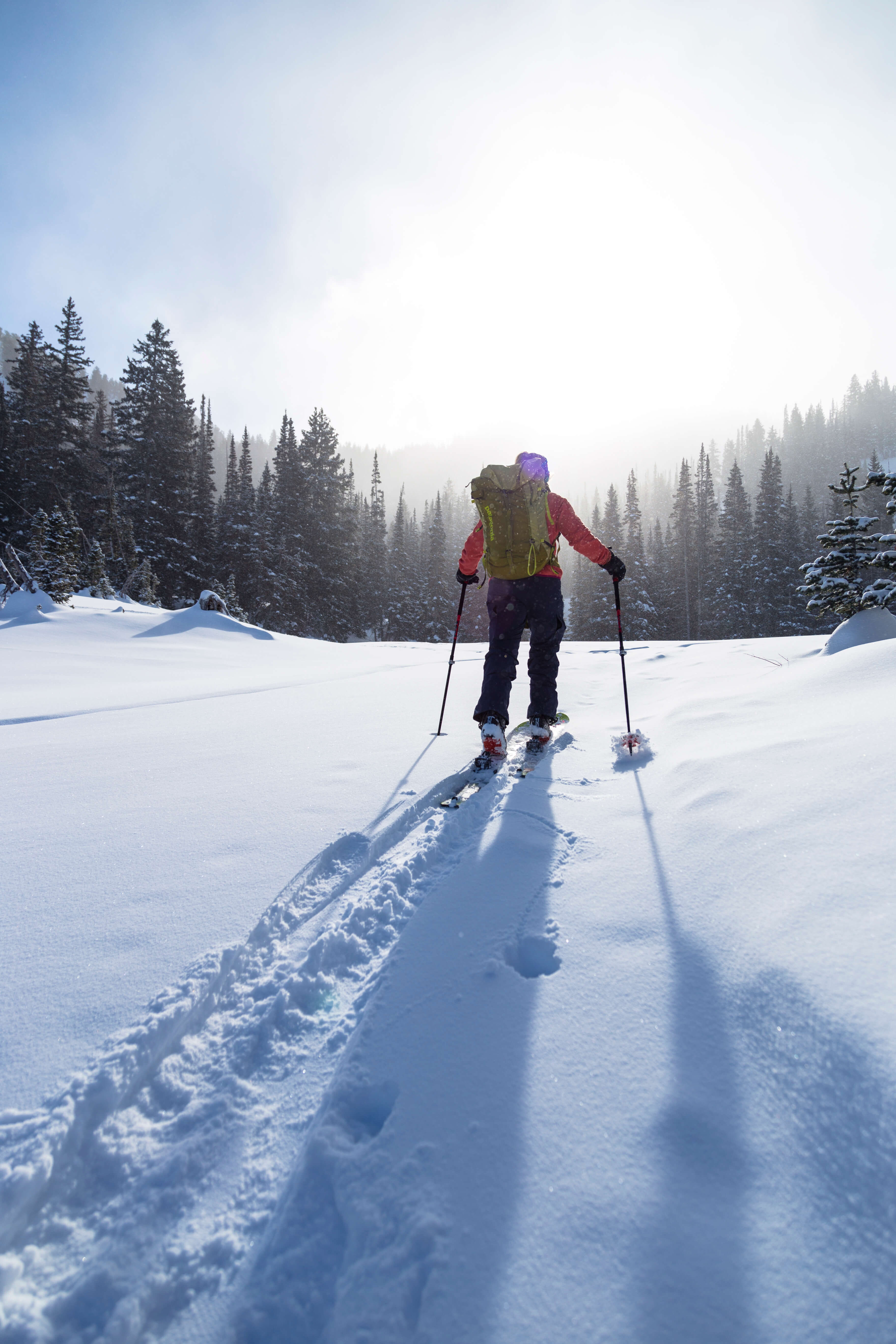
Twenty-five minutes. That’s how long it takes to go from a stoplight in Salt Lake City to a skin track in avalanche terrain. Well, that’s an ideal perfect day. Add some traffic? Still, just a stone’s throw away from skiing.

No other major range in North America compresses a city, a highway, and 11,000-foot peaks into that little space. It’s the best thing about skiing here and it’s also the trap. When the mountains are that close, planning starts to feel optional. You throw the skis in the truck, drive up the canyon, park wherever there’s a gap, and follow the track that’s already there.

I’ve watched that habit put competent people in bad places. Not because they were reckless, but because in the Wasatch you can be standing under 800 feet of loaded, 35-degree, north-facing start zone forty minutes after leaving pavement, and the skin track that got you there was put in by somebody who was having a different kind of day.

This is a guide, not a sales pitch (you’ll see the sales pitch via those fancy CTA buttons here). By the end you’ll read about which maps to use, how to turn an avalanche forecast into a specific line on a specific slope, how to think about terrain the way guides do, where the canyons actually go, and how to handle the parking and road logistics that sink more Wasatch tours than weather does. If you want the gear-and-fundamentals version first, start with our Backcountry Skiing 101 primer and come back here.

The core idea is simple and it’s the only thing I really want you to take away: the tour is planned at the kitchen table the days or the night before, and the mountain gets to vote on whether you execute it.

From beginners to experts, a custom winter guided day in Utah's diverse backcountry.

Guided Backcountry Ski Tours in the Wasatch

Start With the Map, Not the Objective

Most people plan backwards. They pick a run they saw on Instagram, then look for a reason it’ll be fine today. Flip it. Open the map first, learn the shape of the range, and build a menu of places you understand. Then let conditions pick from the menu.

Here’s the map stack I actually use, and what each one is for.

The Wasatch Backcountry Skiing Map. Steve Achelis’s Wasatch Backcountry Skiing Map is the local standard, and if you ski, ride, or hike in the Central Wasatch, you should own it. It indexes more than 1,000 named backcountry locations across the Central Wasatch and comes as a waterproof paper map, a 3D desktop version, and GPS-aware iOS and Android apps that work without cell service. The mobile version shades slopes at roughly 30 degrees and steeper in red, which is exactly the filter you want on a phone screen at 6 a.m. Profits from the paper map go to organizations working on avalanche safety and preservation of the range, which is a rare thing to be able to say about a map.

Its companion, the free Wasatch Backcountry Skiing Guide, is the part people underuse. Hundreds of locations link out to photos and details: difficulty, skinning distance, vertical gain, parking notes, and which zones see helicopter or snowmobile traffic. It’s the fastest way to figure out whether the thing you’re looking at on the topo is a 1,200-foot meadow or a cliff band with a name.

What the Wasatch map doesn’t do. Andrew McLean made this point years ago and it’s still the right one: the map shows you trailheads and destinations, not approaches. Knowing where the Crow’s Feet are is a completely different skill from knowing the best way, and the best day, to get there. Treat the named-run map as a vocabulary list, not an itinerary. Additionally, I would use the apps below for terrain analysis (especially slope angle shading)

CalTopo, Gaia GPS, or onX Backcountry. This is where you do the actual work: slope-angle shading, aspect shading, measuring the pitch of a specific 200-foot roll, drawing your up track and down track as separate lines, dropping waypoints on decision points, and exporting the whole thing to your phone and watch before you lose service. Slope-angle shading is the single highest-value layer in backcountry skiing, and it’s worth paying for a subscription that lets you cache it offline. One caution: shading is derived from a digital elevation model, and DEMs smooth things out. A slope shaded 28 degrees can hold a 34-degree convexity that the model never saw. Use shading to filter, use an inclinometer to decide.

The Utah Avalanche Center site and app. utahavalanchecenter.org is not just the forecast. The observations feed is a live map of what people saw yesterday, and in a range this heavily traveled, that’s better information than most forecasts anywhere else in the country. Before a tour, filter observations to your zone and read the last week.

Paper and books. Carry a paper map and a compass and know how to use them, because phones die in the cold at the exact moment you need them. For depth, Wasatch Tours (Kelner and Hanscom) is the historical classic, Tyson Bradley’s Backcountry Skiing Utah and Jared Hargrave’s Backcountry Ski & Snowboard Routes: Utah cover routes at a practical level, and McLean’s The Chuting Gallery is the Wasatch steep-skiing canon. Read the last one for inspiration, not for a to-do list.

Want to Learn all this from Experts?

Our Mentorship Program

The Five-Step Tour Plan

This is the sequence. It takes about twenty minutes at home and it’s the whole job.

Step 1: Read the forecast before you pick the objective

Pull up the Salt Lake area forecast (or Provo, Ogden, Logan, or Uintas, depending on where you’re headed) and read all of it, not just the color. The overall danger rating is a headline. The information that changes your day lives underneath it: the danger rose, which breaks the rating down by aspect and elevation, and the avalanche problems, which tell you what kind of avalanche you’re being warned about and how it behaves.

The distinction matters enormously. A wind-drifted snow problem confined to upper-elevation northeast aspects is a problem you can plan around by choosing a different aspect. A persistent slab problem on buried facets is a problem that follows you around the range, breaks wider and deeper than you expect, and can be triggered from flat ground below the slope. Same danger rating, completely different day. The UAC’s forecast tutorial walks through how to read each piece, and it’s worth thirty minutes even if you’ve been touring for a decade.

Step 2: Turn the rose into a shape on the map

This is the step almost everyone skips, and it’s the one that converts reading into decisions.

Take the aspects and elevations flagged in the rose and go find them on your map. If the problem is north through east above 9,500 feet, then in CalTopo you turn on aspect shading, look at your candidate zone, and physically identify every piece of terrain in your plan that falls inside that window, including the slopes you’re only traveling underneath, and the ones you’d cross to get out.

You end up with a map that has no-go polygons on it. Everything else is negotiable. When you’re standing at a fork in the skin track at 9 a.m. debating with a friend, this is the artifact that ends the debate, because you drew it when nobody was cold, tired, or looking at untracked snow.

Step 3: Pick from a menu you’ve already built

Good touring partners have a mental list of maybe fifteen tours, sorted not by how fun they are but by which conditions they suit: a low-consequence day, a high-danger day, a wind day, a spring corn day, a whiteout day when you need trees for visibility, a Sunday when the canyons are a zoo.

Build that list over a season and write it down. On any given morning, planning becomes matching, which takes ten minutes instead of an hour and produces much better decisions than deciding at the trailhead.

Step 4: Draw the actual day

Not “let’s go to Days Fork.” Draw the line. Where does the skin track go, specifically? What’s above it? Where do you regroup, and is that spot out of the runout of anything? Where’s the summit or high point, and what’s the turnaround time? What’s the descent, and what’s the alternate descent if the first one has wind slab on it? Where’s the bail-out that gets you to a road, and how far is the walk if you take it?

Set a turnaround time and write it in the plan. Not a vibe, a time. Then set two or three explicit decision points: a specific meadow, a specific ridge where the group stops, looks around, and asks whether what you’re seeing matches what you predicted. If it doesn’t, that’s information, and the plan changes.

Step 5: Logistics and the human stuff

Parking, road status, gear check, and who you’re going with. Then send the plan to someone at home with a check-in time and a “call for help if you haven’t heard from me by” time. Include your vehicle, your trailhead, your intended route, and your bail-outs. A plan nobody else has isn’t a plan, it’s a hope.

Blog Post: Backcountry Skiing 101

Learn More Touring Basics

Terrain Management for Backcountry Skiing

Terrain is the only variable in this sport you fully control. You don’t get to choose the snowpack or the weather. You choose, every few minutes, what slope you’re standing on and what’s above you. That’s terrain management, and in a range with a snowpack as moody as ours, it’s most of the game.

Thirty degrees is the number. Avalanches happen on slopes steeper than about 30 degrees. Ian McCammon’s analysis of 496 avalanches found that 95 percent of hard slab avalanches occurred on slopes between 30 and 45 degrees. Below 30, slabs generally don’t release. So the highest-leverage skill in backcountry skiing is knowing the angle of the slope you’re on, not guessing it. Buy an inclinometer (or download an app), use it constantly for a season, and calibrate your eyeball. Almost everyone underestimates steepness, and almost everyone underestimates it in the direction that gets them hurt.

Aspect and elevation are the primary filter. An analysis of Utah avalanche fatalities going back to 1940 found most occurred on north and northeast-facing slopes above 9,500 feet. That’s not a coincidence, it’s the shadowed, cold, wind-loaded terrain where our persistent weak layers will and can linger through winter. It’s also, inconveniently, where the best snow is. Learn to want the other aspects sometimes.

The slope you’re on is not the only slope that matters. This is the lesson of Wilson Glade, and every skier in this range should know it. On February 6, 2021, two separate parties were caught in a hard slab avalanche in the Wilson Glades between Mill Creek and Big Cottonwood canyons. Four people died. The UAC’s accident report recorded the slope angle at the crown profile at 31 degrees, on a northeast aspect at about 9,600 feet, on a day the forecast rated the danger HIGH for exactly that aspect and elevation band. The slab was roughly three and a half feet deep and ran about a thousand feet wide. The report also notes what made the place dangerous in the first place: the Glades are perceived as safer than the steeper terrain on either side, they rarely slide naturally, and there had been a documented history of close calls there, including one about a month before.

Thirty-one degrees. Trees. A run that reads as mellow on a map. Terrain management means asking what the slope connects to, what’s overhead, how wide a failure could propagate, and what the snowpack is capable of that day, not just how steep the turn under your skis feels.

Trees are not anchors. For a stand of trees to meaningfully anchor a slab, it has to be tight enough that you can’t ski through it. If it skis well, it’s not protecting you. Glades in the Wasatch have killed or injured people who believed otherwise.

Ask the consequence question, always. Not “will it slide” but “if it does, where do I end up.” A small avalanche on an open apron is survivable. The same avalanche above a gully, a creek bed, a cliff band, or a stand of dense timber is not. Terrain traps turn minor events into fatal ones, and the Wasatch is full of them.

Manage the group, not just the slope. One at a time on anything consequential. Regroup in genuine islands of safety: ridges, dense trees, benches out of runout paths, and not at the bottom of the apron where it feels natural to stop. Spread out on the skin track when you’re under something. Watch each other ski, all the way to the stop.

Design your skin track like a guide. The track is a decision, not a given. Keep it low-angle, out of runouts, on ridges and benches where possible, and never let convenience route you across the middle of an unsupported, wind-loaded slope. And this is the hard part in the Wasatch: an existing skin track is not evidence of anything. It means one party went that way, on a different day, with different information, and lived. Track them if you agree with the line, break trail if you don’t.

A Wasatch Terrain Menu, Canyon by Canyon

Every zone below contains avalanche terrain. None of these is a “safe tour.” What follows is orientation, the geography you need to make the map make sense.

Mill Creek Canyon. The winter gate closes the upper road at Maple Grove, which means a longer approach and a much quieter canyon when clear of the main road. Big Water and the Desolation Lake side offer moderate rolling terrain and good tree skiing; Alexander Basin and Wilson Peak hold serious, consequential terrain directly above ground that looks benign. Dogs are allowed here, which they are not in the Cottonwoods.

Big Cottonwood Canyon. The workhorse. Butler Fork (Mill A Basin, Circle All Peak, Gobblers) is the classic moderate day with easy access. Mill D North runs up to Desolation Lake with long, mellow gains and steeper options off the ridges. Days Fork, Cardiff Fork, and Silver Fork all climb toward the Alta ridgeline and offer everything from meadow skiing to genuinely serious lines. Mineral Fork and Broads Fork are bigger, longer, and stacked with major avalanche paths; good objectives when you know the range, poor places to learn it.

Little Cottonwood Canyon. The steepest, most consequential terrain closest to a highway anywhere in the country. White Pine gives you a long, moderate skin into a big glacial basin with serious walls above it. Red Pine and Maybird go deeper toward the Pfeifferhorn and get committing fast. Grizzly Gulch and Flagstaff, accessed from Alta, are the shortest routes to real backcountry skiing in the range, and are correspondingly crowded. Cardiac, Toledo, and the chutes above Tanners are expert terrain with expert consequences.

The Park City side and the ridgeline. Guardsman Pass road is closed to cars in winter, which turns the whole Brighton-to-Park City ridge into a touring zone. Terrain here is generally lower-angle and more forgiving, but it’s also a jigsaw of resort boundaries, private land, and permitted operations, and some of what feels like backcountry isn’t. Solitude’s Highway to Heaven area, for example, sits inside the resort boundary all the way to Twin Lakes Pass and may receive explosive avalanche mitigation at any time.

The Southern Wasatch. American Fork Canyon closes at the Tibble Fork gate and the Alpine Loop shuts for the winter, so approaches get long. Provo Canyon, Cascade, Box Elder, and the north side of Timpanogos hold big, beautiful, committing terrain with a fraction of the traffic; and a much longer rescue timeline. We run guided days down here specifically because it’s where you go when the Cottonwoods are a parking lot.

The Northern Wasatch. Bountiful and Farmington ridges, and the Ogden-area mountains around Ben Lomond and Powder Mountain. Different snowpack, different forecast zone, often a good answer when the Salt Lake zone is loaded up.

Access, Parking, and Roads

This is the part that ruins otherwise well-planned days, and it changes every season. Verify before you go.

Start at UDOT’s Cottonwood Canyons travel resources page for road status, cameras, mileposts, and parking restrictions, and follow @UDOTCottonwoods for real-time updates. A few things worth knowing:

  • The canyons close. For avalanche control, for storms, for accidents, sometimes for hours. Little Cottonwood also runs interlodge restrictions that can legally confine you indoors. Never build a plan that depends on a road opening at a specific minute.
  • Traction laws are enforced in both Cottonwoods during winter conditions, and UDOT runs a vehicle sticker program to speed up checks. Get the sticker.
  • Parking is regulated, not casual. There are no-parking zones near the White Pine trailhead, including a year-round emergency-vehicle-only zone at the lot entrance that exists so Search and Rescue can get in. The Town of Brighton requires paid parking reservations along the upper Big Cottonwood road. Violations get you towed or cited, and towing on a powder day is a special kind of misery.
  • The bus is often the better play. UTA ski buses run to both Cottonwoods for a small fare, free with Alta, Snowbird, Solitude, Brighton, or Ikon passes, and the canyon-mouth park-and-ride lots fill by about 8:30 a.m. even midweek. The Wasatch Backcountry Alliance has also run a free backcountry shuttle in some seasons depending on funding, check their resources page for the current version, plus parking alerts and the daily Wasatch Powderbird operating plan.
  • Resort uphill and boundary policies vary and change. Check with the specific resort every season, and remember that backcountry accessed through a resort gate is uncontrolled terrain requiring the same gear, skills, and judgment as anywhere else.
  • No dogs in the Cottonwood Canyons. It’s a Salt Lake City watershed rule, it’s enforced, and it’s not negotiable. Mill Creek and the Park City side are different.

Timing the Season

November and December. Shallow, sharky, and structurally the most dangerous snowpack of the year. Clear high-pressure spells turn a thin early snowpack into faceted sugar that haunts the range until March. This is the season for low-angle terrain and long skin tracks, not for the line you’ve been thinking about since August.

January and February. Deepest snow, best powder, most variable hazard. This is when the range rewards people who read the forecast carefully and punishes people who don’t. In recent years, lingering persistent weak layers common to November and December have extended through these months. 

March. Frequently the best month in the Wasatch. Deep base, longer days, better-behaved snowpack (sometimes), and the beginning of the corn cycle.

April and May. Spring ski mountaineering. Now you’re managing a freeze-thaw clock instead of a slab problem: start in the dark, be on your descent when the surface softens an inch, and be off the aspect before it turns to soup. Wet-loose and wet-slab avalanches are timing failures, not terrain failures. Aspect rotation through the day is the whole skill.

An Honest Word About Difficulty

The Wasatch is a forgiving place to start and an unforgiving place to push. The trailheads are close, the vertical is quick, and the consequences arrive faster than almost anywhere else in the country. Our snowpack is an intermountain snowpack with continental manners: it takes big storms, and it also builds persistent weak layers that stay reactive for months.

You cannot plan your way around that with a map alone. Take an avalanche course: Level 1, then a dedicated rescue course, then Level 2 once you’ve made a few hundred real decisions. Practice with your beacon until finding a burial is boring. Then get out with people who’ve been reading this range for twenty years, because the gap between knowing the theory and knowing that this particular aspect at this particular elevation goes bad in February is a gap that only local mileage closes.

And travel with flexibility. Keep three tours in play so a bad wind report on one becomes a great day on another.

From Utah to Alaska

Explore Our Trips

Leave It As You Found It

These canyons are Salt Lake City’s drinking water and its backyard, and they stay good because the people who use them keep them that way. Pack everything out, respect the watershed rules, don’t cut new tracks through closed or sensitive terrain, and hold yourself to Leave No Trace principles the same way you would on a bigger trip somewhere else. Report your avalanche observations to the UAC. That feed is a public good that only works if you contribute to it.

Come Out With Us

We guide here every day, all winter. If you want to compress five seasons of learning this range into a handful of days, that’s what a private backcountry ski guide is for: you pick the goals, we pick the terrain that matches the day, and you spend the whole time watching how those choices actually get made. Our Introduction to Backcountry Skiing course and mentorship programs are built for people who want the systems, not just the turns.

But if you’d rather build it yourself from this guide, do it. Open the map tonight, pick three tours, and write down what would have to be true for each one to be a good idea.

The Wasatch will give you the best fifty days of your life. It just wants you to plan them first.